Using Google Maps
The UK Prominent Peaks are supported with links to map websites. Google Maps has been chosen to show both large area and local area maps. The following notes aim to show the main features of the Prominent Peak maps. For full information on using Google Maps, the user is referred to Google Maps Help
Note that there are some variations in the way navigation controls are displayed.
Finding Maps
The map finder page can be a starting point to help you find any Google Map for the UK Prominent Peaks. This page can help you find wide area and local maps. Alternatively the local maps can be accessed via the Excel tables.
Basic Capabilities
UKPP Google area maps appear with icons representing all the Prominent Peaks in the area covered. In the case of the 4 hills on national borders (Wales/ England - Black Mountain; Scotland/ England � Carter Fell, Windy Gyle and The Schil), this means that they each appear in 2 area maps. This is intentional but is at odds with the database, where they appear just once � Black Mountain in Wales and Carter Fell, Windy Gyle and The Schil in England.
© 2008 Google � Map Data � 2008 Tele Atlas
On the left, there is a Contents list showing details of every Prominent Peak in the map file. The map shows the Prominent Peaks of East Ulster � the Mourne Mountains and Antrim Hills.
© 2008 Google � Map Data � 2008 Tele Atlas
The navigation control allows the user to pan in north, south, east or west directions. The +/- zoom control allows the user to zoom in and zoom out.
There are a large number of peaks shown on large-scale maps. For example, the map showing the Prominent Peaks between Glasgow/Edinburgh and the Great Glen: the Ben Nevis family , contains 586 Prominent Peaks. Not surprisingly, these are not all displayed when first loaded and instead a subset appears.
© 2008 Google � Map Data � 2008 Tele Atlas
Finding a Peak
© 2008 Google � Map Data � 2008 Tele Atlas
The Contents list can be used to find a particular peak. For example, if Ben Macdui is clicked on the Contents list (above), it will be displayed on the map.
© 2008 Google � Map Data � 2008 Tele Atlas
If the user zooms in to a particular part of the map, more peak symbols will appear. Also, if the user clicks on peak names in the Contents list, then the symbol for the peak will appear on the map if not previously displayed. The whole list can be displayed on a wide area map by clicking through the names in the Contents list as shown here.
If the user then wants to pan and zoom in to the area around Ben Macdui, a more local view is displayed. Note that in the detailed view all peaks get displayed.
Map Views
Google Maps support three views of an area selected by the buttons on the top right of a map.
© 2008 Google � Map Data � 2008 Tele Atlas
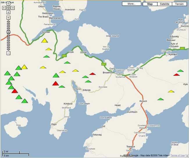
The default view generated for the UK Prominent Peaks is the Terrain view.
© 2008 Google � Map Data � 2008 Tele Atlas
The Terrain view of the south of Skye is shown above. This is useful as it gives an impression of relief.
© 2008 Google � Map Data � 2008 Tele Atlas
The map view shows the Prominent Peaks and road information.
© 2008 Google � Map Data � 2008 Tele Atlas
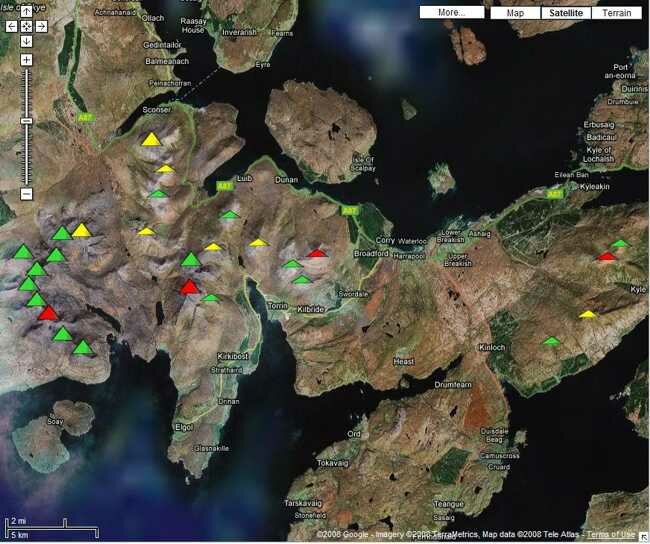
The Satellite view shows the view from space with the Prominent Peaks annotated. Note that the quality of the satellite varies considerably. There is excellent detail for Snowdon but the resolution is poorer in northern areas.
Limitations
If a map is viewed after zooming in to a particular mountain, there may be slight anomalies. The coordinates for the map files used with Google Maps are converted from OS grid references.